A Tool Use Guide
This is a brief How-To guide for the map toolbar. Each tool icon is shown below with tips on what they do and how to use them.
 Zoom
Zoom
The Zoom control displays on the top right of the map when using larger screens. On smaller smartphone screen the Zoom control icon is removed and pinch zoom is used.
 Full Screen
The Full Screen control expands the map to use the entirety of the devices screen space. This can be useful on smaller devices. You can go back to the initial view by pressing the control a second time.
 Locator
Use the Locator control to find and auto-zoom to your current location. On clicking the icon, you will be presented with an option to allow or block the locator.
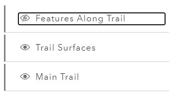
 Layer List
The Layer List shows the three primary data layers in the map: Features Along Trail, Trail Surfaces, and Main Trail. This tool can be used to show or remove the layers in the map dispaly by clicking on the eyeball icon next to a layer:
 Legend
The Legend shows the symbology of each layer activated in the Layer List. For example, the Trail Surfaces layer has diferent symbols showing the types of trail surfaces:
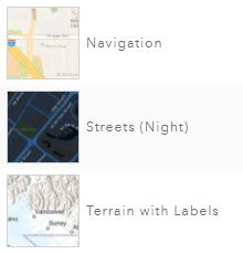
 Basemap Gallery
The Basemap Gallery allows you to use the basemap of your choice! There are many maps to choose from here, just scroll through the list and click one that looks interesting or useful to you:
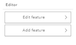
 Editor
The Editor tool allows you to record point features from your own device. There are several steps to accomplish this:
Step 1
On clicking the Editor icon you can choose to add a new feature or edit one you've previously recored:
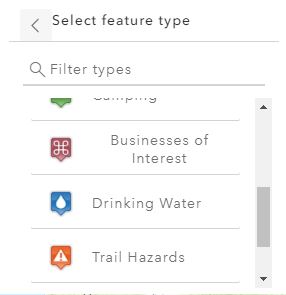
Step 2
You will then be able to select the type of feature you want to place by scrolling and clicking a feature marker:
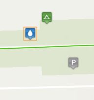
Step 3
The marker will be added to the map wherever you touch the screen:
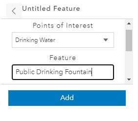
Step 4
You will then be asked to fill in several fields to be included with the point. This info will also show up in popups on the map when clicked later.
The fields we ask you to fill out are:
Main category
Feature name
General notes
Step 5
After filling out the fields and closing the Editor window you will be able to see your point and view the info you entered in a popup!
 Elevation Profile
The Elevation Profile tool allows you to easily see the elevation changes along a section of trail - chosen from either the Trail Surfaces layer or the Main Trail layer.
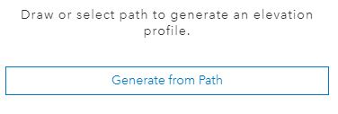
Step 1
Click the Elevation Profile icon on the map and choose Generate from Path:
Step 2
You are then given a brief prompt to select a path (any part of the trail line):
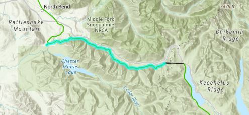
Step 3
When you select a trail section on the map it will become highligthed (you may have to open and close the window manually on smaller screens):
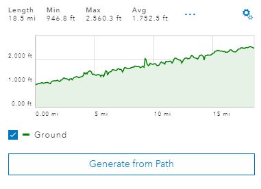
Step 4
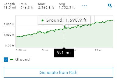
The summary of elevation changes along this section will be dispalyed in the Elevation Profile window (you may have to open and close the window manually to see your results):
Step 5
You can use the cursor or your finger to slide along the profile graph and see the elevation change:
This will simultaneously track along both the profile graph and the trail line on the map - so you can see the elevation changes along any part of the trail section!
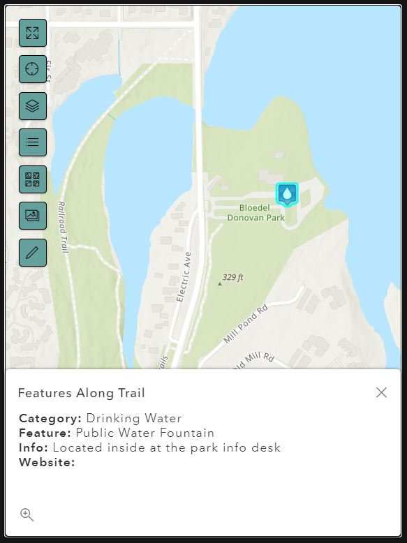
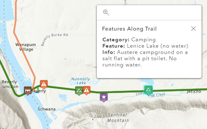
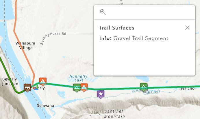
Popups
There are also popups for each Feature Along Trail point and for Trail Surfaces sections. Simply click on a feature to see info:
Hopefully this is a useful tool for you - best of luck on your adventures!